Traveling through southeastern Utah has not always been easy. The canyons of the Colorado River and its tributaries pretty much dictated where the traveler should go. The crossing of the Colorado at Moab was a most important landmark and was the only “easy” crossing of the river north of the Mojave Indian villages (near present day Needles, California) until one reaches the Grand Junction, Colorado area. “Easy” is a gross overstatement really, for although it was easy to get to the crossing by trail, getting across was another matter. Many times during the summer flood period or after rain-induced flooding or during the spring breakup of the river ice, it was most difficult to get across the river and many men and animals have lost their lives in the attempt. The river is fast and treacherous and even today swimmers in the river occasionally drown.
The first European to reach the Colorado River at Moab, and tell about it, was Juan Maria’ Antonio Rivera, who was sent out from Abiquiu, New Mexico, a frontier town, by Governor Cachupin of Spanish New Mexico to search for minerals and other riches in the northern frontier. About the 16th of October in 1765, Rivera reached the Colorado River at what is now Moab, carving a cross with the inscription “Viva Jesus” and his name and the date at the foot on “the shoot of a white poplar.” Undoubtedly the white poplar is a cottonwood which grows in the valley. Rivera was most likely guided to the spot by some of his Indian friends, for there are many indications that this was a main travel route for Indian parties over the centuries.
Rivera did not cross the river but his explorations and those of other Spaniards and later Mexicans, New Mexicans and Americans who came over this main route developed a well-beaten path that with its various branches came to be known as the Spanish Trail or in later days the Old Spanish Trail. The branch through Moab Valley was the southern or winter trail. The northern branch went from Taos, New Mexico over Cochetopa Pass in the Colorado Rockies and came down through the Grand Junction region, meeting the southern branch near Floy Junction east of Green River, Utah. The northern route was closed most of the year by heavy snows in the mountains and used mostly in late summer and early fall.
 The Spanish Trail led, when it was finally completely traversed by William Wolfskill in 1830-1831, from Abiquiu, New Mexico to San Bernadino, California. The crossing of the Colorado at Moab is described by Orville C. Pratt of Santa Fe, New Mexico in 1848 as being via an island some 600 yards upstream from the Portal, the place where the river once again enters into the canyon.
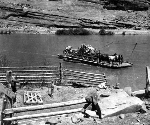
The Spanish Trail continued in heavy use through the 1830s and 40s as annual fall trading expeditions of up to 300 men with pack animals took New Mexico cotton and woolen woven goods to California to trade; they brought back herds of up to 4,000 mules and horses. Undoubtedly the horses and mules were forced to swim the river ford but cottonwood log rafts were the favorite means of crossing, as several chronicles tell of rafts left on the banks of the crossing, used by both Europeans and Indians.
During the early settlement period of Moab and southeastern Utah, the crossing was still via one of the three islands shown on United States Geological Survey maps of the river. Ferdinand Dickert of the surveyor general’s office in Salt Lake City in November of 1878 surveyed the road through the valley, passing on the south edge of the Mormon Fort west of present day Moab and crossing by way of an island across from the uranium mill’s tailings pond today.
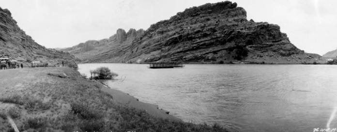
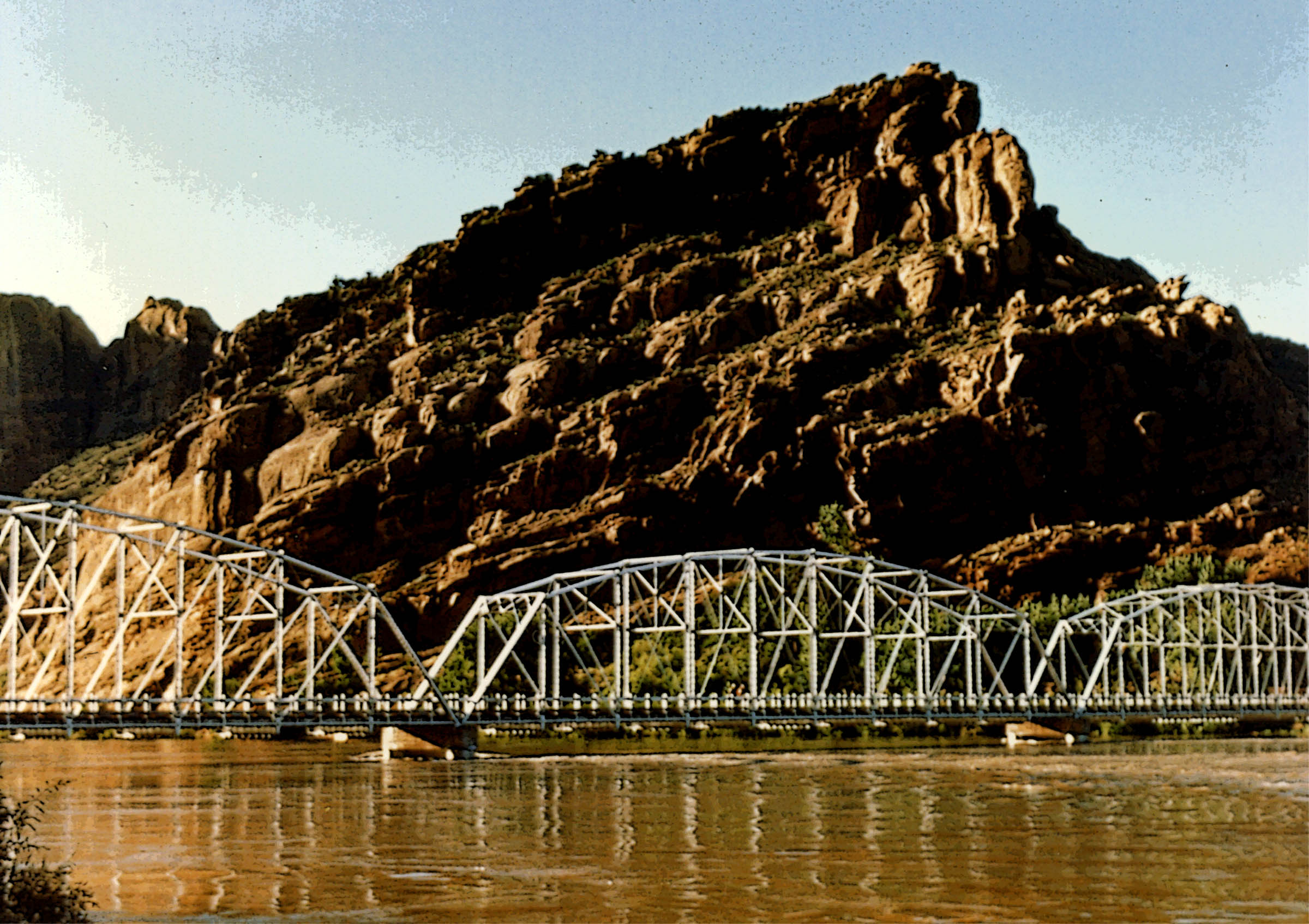
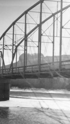
A few years later, in 1882 or 1883, Norman Taylor had a flat boat 60 feet by 16 feet wide built as a ferry boat which ran on a cable across the river and was propelled by the force of the stream current. The ferry was located above the present concrete bridge at about the site of the old steel bridge. The ferry remained in use under various owners, including the county; some of them were lost down stream, until the steel bridge was built in 1911.
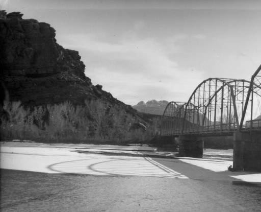
The three span, simple truss, steel bridge on concrete pilings was built across the Colorado River at a cost of $45,000.00 by the Midland Bridge Company of Kansas City, Missouri. In 1920 it was raised some four feet at a cost of $70,000.00. The concrete piling at the north end of the bridge remains on the bank of the river today to remind us of past endeavors.
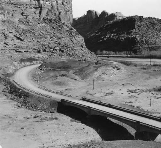
The mouth of Courthouse Wash was bridged in March, 1915. The steel, simple truss bridge was 101 feet long, 16 feet wide, weighed 85 tons, had a concrete floor and was painted olive green. The bridge, dedicated on March 13, 1915, replaced a ford and a dugway road on what must have been a treacherous crossing of the wash especially when Colorado River flood waters backed up into the mouth of Courthouse Wash or when summer floods came down the wash. The remains of the dugway are still visible today just outside of the highway right-of-way within Arches National Park, just as they were in the photograph taken at the bridge dedication. The only thing missing in the photograph are today’s willows, cottonwoods and the imported tamarisk now growing in profusion along the stream bed.
The old steel bridge over Courthouse Wash gave way to progress in 1934 when a new three span concrete bridge in the style of several others in southeastern Utah was built. The request for bids on the project was advertised in November of 1933. It was to be rigid concrete, three spans, gravel surface approaches, .359 miles in length and costing approximately $40,000.00. A temporary bridge and detour were part of the project. Skilled labor was to be paid a minimum wage of 60 cents per hour, unskilled 50 cents.
A 1936 photograph in the Dan O’Laurie Museum collection taken by Harry Reed, Moab photographer, shows a new bridge and a deep road cut leading to the river. Previously, the road from the river apparently went around the small mound of dirt and rock to the southwest of the present bridge, between it and the river bridge.
The old three span steel river Colorado bridge was replaced in 1955 as heavy traffic from uranium ore trucks from mines to the south proceeded to the buying station and new mill north of the river. The legally overweight ore trucks were too hard on the old horse-and-buggy age bridge.
NPS veteran and historian Lloyd Pierson still lives in Moab, Utah. Since he first penned this article, yet another ‘new’ bridge has been constructed over the Colorado River and Courthouse Wash. The new four lane river span cost upwards of $38 million…JS
To read the PDF version of this article, click here. and here.
Don’t forget the Zephyr ads! All links are hot!


