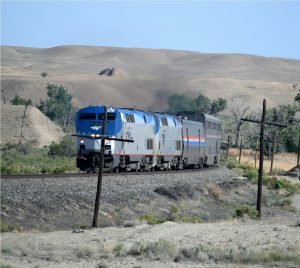
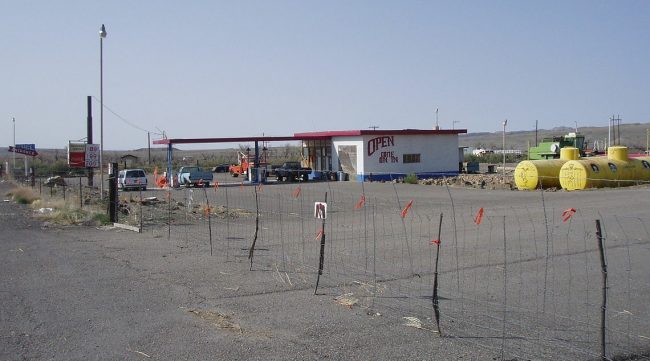
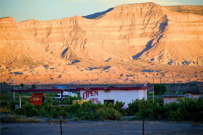
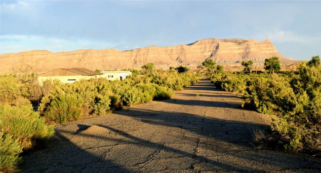
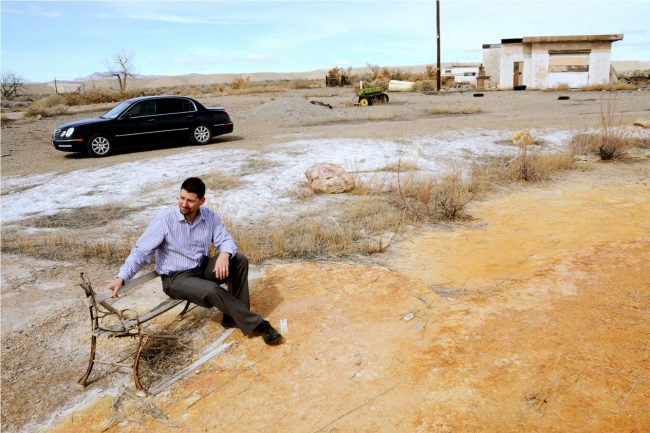
 The trains don’t stop at Woodside any more. After the geyser stopped erupting the people didn’t go there anymore and the cars don’t stop there anymore. Now you can buy Roy Pogue’s 700 acres, abandoned buildings and assorted junk for 3.9 million dollars. Woodside, Utah is located on the west bank of the shallow Price River in the nearly uninhabited eastern part of Emery County, Utah. Its fenced-in filling station is one of the only signs of human activity along the lonely stretch of U.S. Route 6/191 between Wellington and Green River.
Development of Woodside began when the Rio Grande and Western Railroad bridged the Price River and needed a water stop. The line from Grand Junction across the Utah Desert to Helper, UT was originally constructed in 1881 by General (William Jackson) Palmer as the Rio Grande Western to connect the narrow-gauge Colorado system with Salt Lake City. The original route followed the Price River west from Woodside, twisting and following every small bend. The standard-gauging was completed in 1890, and the RGW continued to operate this new mainline until 1908, when it was merged into the consolidated Denver & Rio Grande Railroad.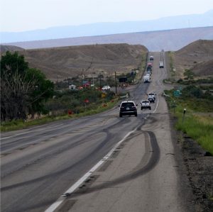
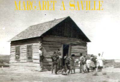
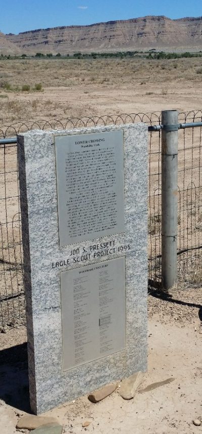
The area’s first resident was a local prospector named Henry H. Hutchinson, who settled there in 1881. Other settlers arrived the following year and soon established a small community with stores, a café and blacksmith shop. After damming the Price River and digging an irrigation canal, they grew a number of products including vegetables, turkeys, cattle, sheep, sugar beets and honey. They called the town “Lower Crossing” because the railroad crossed the river there.
As the town grew, adding a few stores and a depot, it was renamed “Woodside” for the numerous cottonwood groves. One of Woodside’s biggest challenges was the Price River. Before the construction of Scofield Reservoir (1946) the streamflow was highly variable, peaking early and nearly drying up by late summer. The river’s large drainage basin also meant that even a distant cloudburst could bring a destructive flash flood. Despite these problems the town continued growing adding saloons, stockyards and a hotel. Woodside became a supply point for neighboring ranches and a schoolhouse built in 1892 served as a town gathering place. In 1897, following a train robbery at Castle Gate, Butch Cassidy supposedly hid in a network of tunnels under one house outside town.
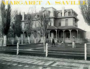
In 1900 the population stood at 114 and at its peak in 1910, it had a population of 328. But railroad facilities in Helper were improved it became a more convenient town. The Woodside Grand Hotel, built in the 1880’s burned down in the early 1900s. In the late 1920s livestock shipping facilities and the depot were removed from Woodside. The occasional flooding of the river caused the farmers eventually to search for better lands. This blow was followed by severe droughts in the 1930s, and by 1940 the population had dropped to 30.
 A 1913 law provided state aid to counties to construct the Midland Trail, with an initial route to follow the present US-6 via Woodside between Price and Green River, but an amendment changed that. The shorter route via Woodside rather than Castle Dale was considered again in 1916, due to problems with maintaining the latter and construction of a new girder bridge over the Price River at Woodside (still stands today).
In 1924, Utah Oil & Refining drilled the Woodside #1 well, located about three and a half miles southwest of the town. The well did not encounter oil, but rather a large flow of helium-rich gas. President Calvin Coolidge set aside the “Woodside Dome Field” as “United States Helium Reserve #1”. The Field never produced any helium because most of the other gas was inert (nitrogen), but the potential reserves are said to be substantial. Today, it remains an untapped helium resource.
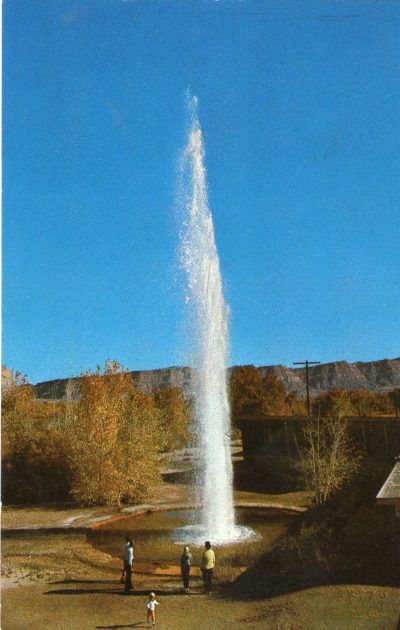
In the 1940s Woodside became a minor tourist attraction. In the 1880s the railroad had dug a large water well here, which had later turned into a cold bubbling mud pot driven by naturally occurring pressurized carbon dioxide gas. The hole was developed into a cold water geyser, along with a filling station, store, and café.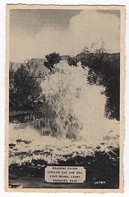
The “geyser” and Woodside became a picnic gathering place for local people as far away as Price and Green River. In the 1960s, the Highway Beautification Act led to the removal of a number of billboards advertising the town’s geyser along U.S. Route 6, which had a major impact on tourist visits and the highway being located further north. The “geyser” formerly spouted as high as 75 feet but is much lower now and barely erupts. Bob Quist told me that the owner, becoming perturbed filled the “geyser” in with concrete. The picnickers retaliated by dynamiting the concrete, which had the opposite effect they expected because the falling rubble filled in the hole and the “geyser” stopped erupting!
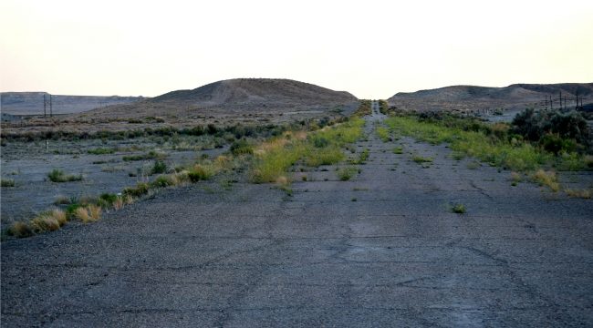
After the café and store burned down in 1970, Woodside became a ghost town. In 1948 the highway abandoned the truss girder bridge and relocated to its present location, and a new gas station was
constructed on the current site.
Roy Clay Pogue bought the 700-acre property in 1990 from a doctor in Provo. He planned to farm and ranch on the land with the water rights that come with it. Instead, he found himself more often helping travelers whose vehicles broke down, so he refurbished the old service station and opened it for business. It still looked run down. When Pogue bought the land it no longer had water or electricity. School buses didn’t come this far, so his wife moved to town two hours away to raise the kids.
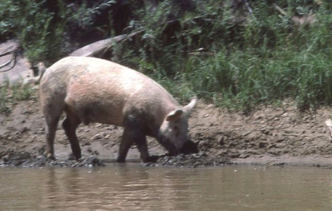
I first met Roy in the late 1970s or early 1980s when he managed the Rose Ranch below Westwater Canyon. We had paid Roy $25 to let us take out and to drive us back to Loma for our vehicles. As we approached the take-out we saw two pigs wallowing in the mud and tried to get photos of them with a bikini on. Roy hearing the ruckus yelled at us to “get the hell out and find our own way back to wherever we came from!” We had to go down to Fish Ford to take out, walked to the highway (it was hot!) and payed a driver $10 to take us to Loma. I forgot about Roy but remembered the pigs through our photos.
From 1995 to 2014 I worked for River Runners in Vernal and shuttled vehicles to or picked up rental boats in Green River. Two to three times a week I’d stop in at Woodside for gas and conversation with Roy. He had a 20′ boa constrictor in an open glass case by the door. I stopped there because Roy had cheaper gas than Green River or Wellington, and I liked him. He’d often give me a pop, if I was alone, and we would sit in the shade and talk. He told me that he “moved away from things and he didn’t want anyone to know anything about “nobody’s business.” Roy became an expert on Woodside, reading books and talking with former residents and he loved sharing that history.
One day I mentioned Westwater and Roy told me he had managed the Rose Ranch. I said when, were you there when they had the pigs down by the river? He looked at me hard, and said: It was you, I thought there was something about you I recognized. We had a good laugh. Roy didn’t particularly care for the government, especially the U.S. Bureau of Land Management. He once had some cattle on the ranch and that’s how his dispute with the BLM began. Roy told me BLM, who “owns” the land next to his ranch, told Roy to stop his cattle from wandering onto BLM land. “They told me I had to fence off my land or get rid of my cattle. I couldn’t afford 11 miles of fencing, so I auctioned off the cattle.” Later, when the BLM began leasing grazing land to ranchers whose cattle strayed onto Roy’s property, he said: “When I complained, they told me I should fence off my property. They want it both ways” Roy said a lawyer told him he could sue the BLM, but the government could tie the case up in court for years. “I couldn’t afford that, either,” he said. So Roy kept a few llamas, a couple of cows, and no fences to keep out the rancher’s cattle.
One day while making change for me, I noticed he kept the 10s and 20s in the same drawer. The next time he opened the register I had worked my way around and saw that the drawer had been modified to hold a pistol. When I asked him, he told me that if someone tried to rob him they were not going to get away with it. Pogue also had some difficulties with the Utah Highway Patrol. People often stopped on the long, wide dirt area leading to his gas station to take a piss. Roy would call the Highway Patrol and they would show up several hours later, telling Roy that it was low priority. Roy told me that he found out where one of the officers lived in Moab and one Sunday morning drove down to the officer’s house and pissed on the lawn in front of the house! It didn’t change anything, Roy told me, but they got the picture!
For a few years Roy’s son lived there making beautiful willow furniture. Now one could easily take Roy and his brother as not being too bright, but I knew better. I knew Roy read a lot, but his brothers neatly done sales brochure showed me how intelligent these men were. The brochure was professionally printed with calligraphy – but what caught my attention was the pricing. It read: “People often ask me how much I will sell a piece for. I tell them that these pieces of furniture are like my children after spending so much time with them. So if you are interested in buying one of them, make me an offer. If I like you and your offer, the deal is sealed with the offer. If I don’t that is the end of our bargaining!”
Roy showed me how to make a number of vehicle repairs, including a gash in a tire by inserting many tire plugs and then putting in one or more cans of Fix-A-Flat. He took me down the Price River to a launch site on his property and shuttled my vehicle around to Swasey’s. A long the ways down the Price River was a “store front” fake movie set. Roy told me several movies were made here including Thelma & Louise driver’s explosion scene in the 1991 film on the abandoned highway and more recently the Mormon church filmed John the Baptist dipped Jesus in the Price River.
Roy Pogue was a Staff Sargent in the U.S. Air Force and he mainly survives on his veteran’s pension. A disabled veteran from Moab, Roy had a hard time finding steady carpentry work. In his 20 years at Woodside he’s ruled his own fate: He’s been a one-man sheriff, judge, jury and good Samaritan. Roy Pogue was more than 67 years old (born on 06/24/1950.) when he moved to live in Green River. His wife,
Mary Christine Pogue passed away on November, 27, 2017.
In his 63 plus years Roy Pogue loved his wife, Chris, and the couple’s six children. He lived on the 700 arid, wind-blown acres, including the abandoned remains of Woodside for 20 years. After decades of sweat, labor, battles weary from fighting with the federal government over cattle and water rights, fights with his wife (who preferred people to llamas), and declining health, Pogue performed the toughest chore of his life: pounding in the for-sale sign. “This place has meant so much to me,” he said. “It’s the closest thing to real freedom I’ve ever known in my life. At this price, it might be a cold day in hell before someone buys it. And maybe that’s good.” Roy Pogue, decided to sell, he’s put it all up for sale and despite its crumbling buildings and junk he’s asking a pretty price: $3.9 million dollars.
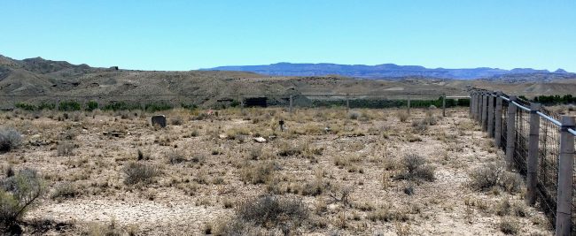
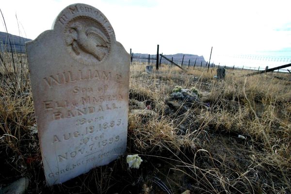
This June I visited Woodside to take pictures. I worked my way up to the cemetery on a windswept hill,
that was as much a repository for tumbleweeds as it was for people. The wind blew between the grave
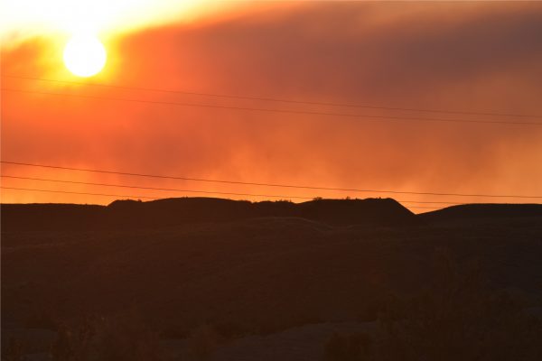
markers and only ugly dirt and weeds cover the graves. I sat there watching the sun set through the smoke
of a fire west of Price. I wondered why the cemetery was on a hill, so far from the town site, and thought
maybe it was above the flood level of the Price River, but then the town would also have been in the flood
plain!
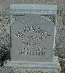
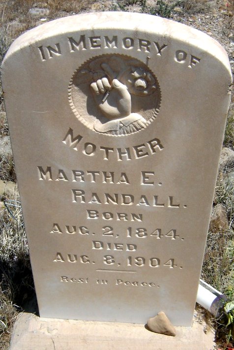
Headstones reveal only the basic statistics of the dead, who each had a living story. Two lone graves at the foot of the hill marked with piles of rocks are supposedly graves of two outlaws who were shot and killed after robbing a bank and not allowed the privilege of being buried with the good folks above. Here beneath me were the cooks, railroad workers, blacksmiths, mothers and fathers… and their children. There was a grave of William Randall, who died at age 16 in 1899, way too early. How did he die? Another announced McKinny, Sarah Wilcox who lived to age 80, what did she do? I was walking around the quintessential Thornton Wilder’s Our Town, but the actors weren’t talking.
History doesn’t go away. But we view history through a perspective that is different from young Randall or the aged Sarah Wilcox. In grade school I learned about how the early settlers used the slash, burn and then move on system to settle the country. When the land was used up, they never thought of the consequences of their actions, they just up and moved somewhere else. Heck, there was plenty of land. We do that with our cities today, when a mall loses its popularity another strip mall is constructed farther away, and other businesses and the people then move and settle near it. We do the same thing with our outdoor recreation, but the thing is there just isn’t any place to move on to. What happens after all of the wide open and free Western lands are posted, or developed for industrial tourism? What happens when we have to pay for our birthright of beauty and solitude? As Woodie Guthrie stated about land: You better take care of what you got, cause they ain’t makin any more of it.
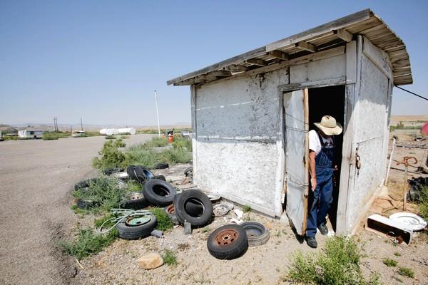
Roy coming out of storage building
Liesik, Geoff; “Utah Ghost Town is For Sale in Emery
County”. Deseret News
– U.S. Geological Survey Geographic Names Information System: Woodside;
– Geary, Edward A. (January 1996). A History of Emery County. Utah Centennial County History Series.
Salt Lake City: Utah State Historical Society. ISBN 0-913738-05-0;
– Liesik, Geoff (July 28, 2012). “Utah Ghost Town is For Sale in Emery County”. Deseret News;
– Carr, Stephen L. (1986) [June 1972]. The Historical Guide to Utah Ghost Towns (3rd ed.). Salt Lake City:
Western Epics. ISBN 0-914740-30-X;
– John M. (September 25, 2012). “A Utah man and his ghost town: a love story”. Los Angeles Times.
– Glennon, J. Alan (May 6, 2005). “Carbon-Dioxide-Driven, Cold-Water Geysers”. Department of-
Geography. University of California Santa Barbara;
– Peterson, James (1956); Inter American Association of Petroleum Geologists – Geology and
Economic Deposits of East Central Utah;
– Chronic, Halka (January 1, 1990). Roadside Geology of Utah. Roadside Geology Series. Missoula,
Montana: Mountain Press Publishing Company. ISBN 0-87842-228-5;
– Woodside cemetery grave marker photos by Teresa Leakey;
– Eastern Utah Advocate, Change Midland Trail, January 21, 1916, p. 8;
– High Country News; Mike Metzger A Utah Realtors’ quest to sell a ghost town; May 2013;
– Our Town is a 1938 three-act play by Thornton Wilder.
All photos by Herm Hoops.
Note: This article has been updated to remove a reference to Roy Pogue’s death. In fact, Roy Pogue is very much alive. We apologize for that serious error. To read a 2012 LA Times article about Roy and the sale of his “ghost town,” click here.
To comment, scroll to the bottom of the page.
Don’t forget the Zephyr ads! All links are hot!

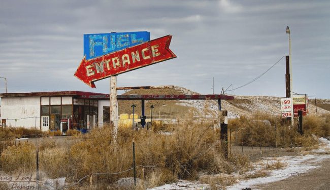
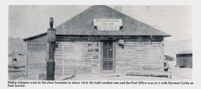
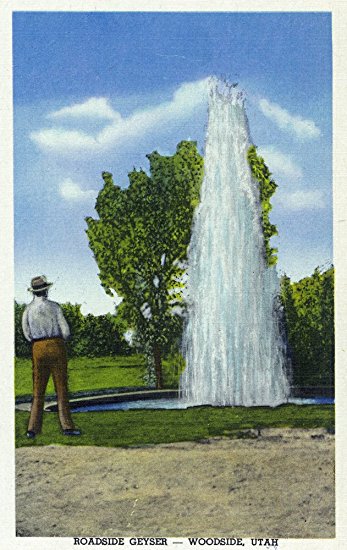
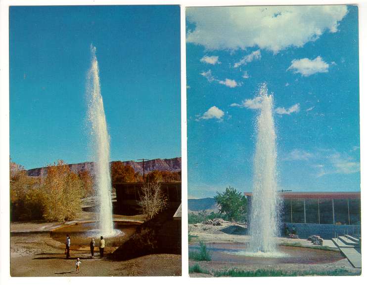
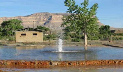











I wonder just when the Woodside Geyser “tourist trap” business actually folded? I was there during a family vacation that I can definitely pinpoint to 1973. We were supposed to be on our way down to Capitol Reef, but I was able to twist my dad’s arm into making a stop at Woodside. This much I remember: There was a little “toll booth” at the turnoff; I think the charge was something like 75 cents per person. There was a tall tin fence (visible in one of the photos above) shielding the geyser from drive-by cheapskates who might try to view or photograph the geyser from the road. We arrived just as the geyser was finishing an eruption. There wasn’t a whole lot to do between eruptions except look around the gift shop or visit the donkey shed. Ordinarily, I would have insisted on waiting it out, but the place was hot and boring. So off we went and I never got to see the geyser erupt. So were there other geyser-specific amenities, exclusive of the town, that went up in smoke prior to ’73?
I was a child in one of those families that visited the geyser from the Green River area in the mid to late 60’s. It was interesting and during eruptions, briefly exciting. Thanks for your article. It brought back pleasant memories.
My grandfather Roy Cook was the owner before Ray, and was the one that built , owned, and ran the Woodside Geyser “tourist trap” from the 1950’s-1979’s. My father moved there permanently in 1955 when he was 8, and lived there until he went to college. From what my grandparents told me as that from time to time vagrants would hole up under the cafe by the geyser. One vagrant lit a fire to stay warm overnight and the cafe caught in fire. Everything was burnt to the ground. Between people throwing garbage down the geyser, and dynamite (it was a vandal not my grandfather), the geyser became too unpredictable. In context of not being able to advertise, sporadic eruptions, and cars not needing to stop for gas (fuel economy), after the burn down, he and my grandma Delilah (Dutchess) moved on to Colorado, then Kansas.
Feel free to contact me if you wish to have further clarification. I was there last week to spread my cousins ashes at the cemetery.
My family is from Dragerton, Utah and knew your grandparents and visited the geyser on our trips back to Olathe, Colorado, where my mother is from, on many occasions. My father prospected the San Rafael/Temple Mountain area and wanted “Steve” Cook to get involved, but he never did.
The cafe had some displays that were loaned to the Cook’s by my dad and were lost in the fire.
Hi Tyson, I am quite interested in the history of Woodside and the surrounding area, with the railway and all. Would you be interested in sharing your knowledge? I’m an archaeologist with the BLM and we are recording Woodside for a project we have currently. We have had difficulty finding who the private owner is to ask permission to the grounds. Is the current landowner connected to your family?
Thanks much!
Natalie
My family still has land in Woodside, the Curtis homestead. It’s nothing but a worn down shack but it holds many memories from when I was a little girl. Loved visiting all my Utah family.
We must be related. Guy Curtis is my great Grandfather. Jimmy Allred is my father.
My great great grandmother is charity Curtis married to a Dickman. Gotta be related in the little town
Tyson. How do I get in touch with you? I missed you at the cemetery by about 2 weeks. I was there on September 16th.
My Family lived there for a while in the early 70’s , my parents ran the gas station and we lived behind it in a trailer, we carpooled to green river with the family that ran the gift shop , to go to school.
Herm, you are one terrific writer and historian. I loved reading this. It has all the makings of a fascinating Nov or a movie based on true facts.
One question tho about photographing the pigs in a bikini. Who or what was wearing the bikini?
Nicholas – Tyson W Cook @ gmail.com (no spaces)
Is the property still available? It’s not listed from what I can tell.
Am I able to buy a plot of land within Woodside itself instead of buying the whole 700 acre ghost town?
Do you know who owns it now? I was wondering if the town is still for sale. I have visited Woodside in the eighties.80’s. Ive always been interested in Ghost Towns. Thanks for any help you might have.
I would love to own this with my fiance but we can’t touch her families money till we are married in October. She told me to find a good place out away from people for us our kids she wishes to have and her 4 girlfriend’s that they all grew up together and she wants horses and cow chickens pigs after being raised in the city all these years and me being raised on farmers growing up.
I have stories passed from from my great great grandparents Henry clouse Dickman and charity Curtis Dickman from 1910 and raising a family there. Growing up we would stop by and my grandpa max ivie and aunt Alice would tell us stories about the mining town and the gyser. I have old pictures i would love to share.
I have stories passed from from my great great grandparents Henry clouse Dickman and charity Curtis Dickman from 1910 and raising a family there. Growing up we would stop by and my grandpa max ivie and aunt Alice would tell us stories about the mining town and the gyser. I have old pictures i would love to share. !
In about 1965 or 66, my Dad & I made a trip from our ranch West of Grand Junction to Salina, Utah for a load of rock salt. We took the 3/4 ton pickup, & my uncle, whose family ran a neighboring ranch, took his 2-ton Chevy truck. Ever thrifty, my Dad took a barrel of gas along so he wouldn’t have to buy any along the way…this was before I-70 was built across the Swell, so we had to go all the way to Price & then south to Salina. On the way back, somewhere south of Woodside, the lug nuts on the rear wheel of my uncle’s truck came loose, and the threads were stripped so it wouldn’t tighten back up…Dad went back to Price & got new lug bolts, but they didn’t have a big enough hammer to drive the old bolts out of the hub. So Dad went back to Woodside and borrowed a big sledge hammer from the guy who ran the geyser. That worked to get the bolts out, we ran the hammer back to the geyser guy, and went on…as I remember it was about midnight before we got back to Grand Junction.
I never knew any more about Woodside until I ran across this article, but I always remembered how the “geyser guy” helped some stranded Colorado ranchers get going again…